Mierzeja Wiślana

Mierzeja Wiślana w miejscowości Mierzeja Wiślana w miejscowości
Mierzeja Wiślana w miejscowości

Opis

Mierzeja Wiślana

Mierzeja Wiślana zwana często Bursztynowym Wybrzeżem jest jednym z najpopularniejszych regionów wypoczynkowych na Pomorzu.

Latem odwiedzana przez rzeszę turystów.

Ciekawostką jest, że Krynica i okolice należą do najbardziej nasłonecznionych miejsc w naszym kraju.

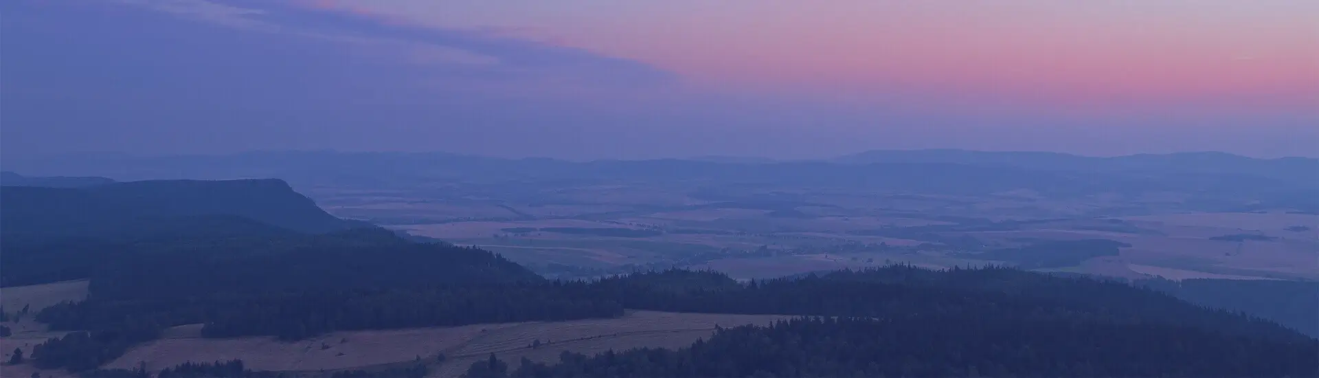
Mierzeja Wiślana ma kształt szerokiego łuku ciągnącego się od Sopotu na zachodzie do Półwyspu Sambijskiego na wschodzie.

Mierzeja jest skutkiem pracy prądów i fal morskich, a po wyłonieniu ponad poziom morza terenem działalności wiatrów.

Szerokość mierzei wynosi ok 500 m w okolicach Krynicy Morskiej do ok. 2,5 km w pobliżu Stegny.

Mierzeja Wiślana to obszar chroniony programem Natura 2000.

Park Krajobrazowy „Mierzeja Wiślana” objęto ochroną prawną w celu zachowania unikatowych w skali kraju walorów przyrodniczych, kulturowych, historycznych i krajobrazowych.

Najważniejsze walory krajobrazowe Parku stanowią piaszczyste plaże, a także mozaika terenu o dużej dynamice rzeźby.

Na uwagę zasługują potężne wały wydmowe.

Ważny element krajobrazu tworzą też zróżnicowane morfologicznie wybrzeża, brzegi porośnięte szuwarami, wysokie klify wydmowe oraz piękne widoki.

Cały obszar wydmowy pokryty jest lasem sosnowym. 

Mierzeja jest pasmem wydm, najwyższe wzniesienie to Wielbłądzi Garb (49,5 m.n.p.m.).

Mierzeję Wiślaną  można podzielić na cztery strefy:

strefę piaszczystej plaży nadmorskiej o średniej szerokości ok. 70 m,

strefę tzw. wydmy przedniej (białej) o szerokości 1-20 m,

■ strefę tzw. wydm brunatnych (zalesionych) o bardzo zmiennej szerokości, 

■ strefę tzw. wydm szarych (pagórków wydmowych) o szerokości max. 80 m.

Charakterystyczne są zatem dla Mierzei szerokie, piaszczyste plaże z kompleksem wydmowo-leśnym.

To idealne miejsce do uprawiania turystyki wodnej, czemu sprzyja dobrze rozwinięta infrastruktura żeglarska i windsurfingowa.

Natomiast połączenie drogami wodnymi z Wisłą i Żuławami czyni z tego terenu wyjątkowy w skali Europy pod względem potencjału dla śródlądowej turystyki wodnej.

Od strony Zatoki Gdańskiej rozciągają się piękne i szerokie plaże.

Plaże Mierzei Wiślanej słyną też z bursztynu, który od wieków jest produktem utożsamianym z tym miejscem.

Najpopularniejszą miejscowością na Mierzei jest Krynica Morska, to najmniejsze miasto w Polsce.

Nie umniejsza to jednak jej pozycji na turystycznej mapie Pomorza.

Należy do najatrakcyjniejszych kąpielisk na polskim wybrzeżu.  

Krynica Morska noclegi to świetna baza noclegowa.

Równie ważną miejscowością po Krynicy jest Stegna.

To miejscowość o charakterze letniskowym, posiada licznie rozwiniętą infrastrukturę wypoczynkową nad morzem.

W zachodniej części Mierzei położone są Junoszyno, Jantar oraz Mikoszewo. Tutejsze plaże słyną z licznie występującego bursztynu, dlatego też w Jantarze odbywają się corocznie finały Mistrzostw Świata w Poławianiu Bursztynu.


Vistula Spit

Vistula Spit, often called the Amber Coast, is one of the most popular holiday regions in Pomerania.

In the summer it is visited by crowds of tourists.

Interestingly, Krynica and its surroundings are among the sunniest places in our country.

Vistula Spit has the shape of a wide arc stretching from Sopot in the west to the Sambian Peninsula in the east.

The spit is a result of currents and waves, and after emerging above sea level, it is an area of wind activity.

The spit is about 500 m wide near Krynica Morska to about 2.5 km near Stegna.

Vistula Spit is an area protected by Nature 2000.

The "Vistula Spit" Landscape Park was placed under legal protection in order to preserve the unique natural, cultural, historical and landscape values.

The most important landscape values of the park are the sandy beaches and the mosaic of terrain with a highly dynamic relief.

Mighty dune embankments are worth mentioning.

Morphologically diversified shores, banks overgrown with rushes, high dune cliffs and beautiful views are also an important element of the landscape.

The entire dune area is covered with pine forest. 

The spit is a range of dunes, the highest one being Camel's Hump (49.5 m above sea level).

The Vistula Spit can be divided into four zones:

the zone of the sandy seaside beach with an average width of about 70 m,

the zone of the so-called frontal (white) dune which is 1-20 m wide

the zone of so called brown dunes (wooded) of very variable width 

the zone of so called grey dunes (dune hills) of the maximum width of 80 m.

Wide, sandy beaches with a dune-forest complex are thus characteristic of the Spit.

It is an ideal place for water tourism, which is facilitated by a well-developed sailing and windsurfing infrastructure.

However, the connection of the waterways with the Vistula River and Żuławy makes this area unique in Europe in terms of potential for inland water tourism.

Beautiful and wide beaches stretch out from the Gdansk Bay.

The beaches of Vistula Spit are also famous for amber, which for centuries has been a product associated with the area.

The most popular place on the Spit is Krynica Morska, the smallest town in Poland.

However, this does not diminish its position on the tourist map of Pomerania.

It is one of the most attractive resorts on the Polish coast.  

Krynica Morska accommodation is a great base.

Equally important town after Krynica is Stegna.

It is a holiday resort with a well-developed infrastructure of recreational facilities at the seaside.

In the western part of the Spit are Junoszyno, Jantar and Mikoszewo.

The local beaches are famous for their amber, which is why Jantar hosts the annual World Amber Championship finals.


Lokalizacja